
First Take: Territories and Territories
The Shifting Guarani Space
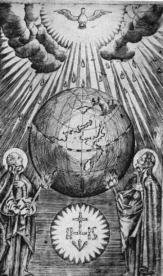
St. Ignatius Loyola and St. Francis Xavier illuminate the world with their torches, copper engraving by the Guarani Indian Juan Yaparí, for a Guarani edition. Illustration from Father J.E. Nieremberg’s Of the Difference between the Temporal and the Eternal,1700.
Territory is one of those useful words with relatively different meanings—but not different enough to prevent us from using it in diverse circumstances without necessarily falling into conceptual errors. Whenever we use the word “territory,” we are referring in principle to an area defined by the existence of something or someone, which imbues the term with meaning (in our case “Guarani territory”).
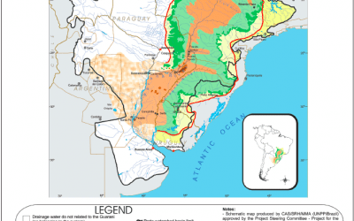
This area generally refers to a concrete space, posing questions of territorial definition: what are the borders? Who determines them and how? What are the effects of territorial change? To demonstrate the wealth of possible answers, we are going back in history some 2,000 years, when the Guarani people already inhabited the area approximately located in what is today the eastern part of Paraguay, southwestern Brazil and northeastern Argentina. First, let’s define “Guarani territory” simply as the place where Guaranis lived. However, it was not an exclusive territory, since other ethnic groups also lived there, and the Guarani people did not claim to control the entire territory. Given the character of the Guarani presence, it was a virtual territory. Because of their semi-nomadic lifestyle and without any permanent architecture, they left no visible traces and did not organize the territory. We could say, however, that although fewer Guarani exist today than before the arrival of the Spaniards, they left an indelible stamp: their language.
This territory began to slowly fragment after the Spanish and Portuguese conquerors arrived. They came from a culture in which land ownership is a fundamental factor (and possibly totally foreign to the idea the Guaranis and other indigenous groups had about the land). The first thing they did was to create borders on the space where they considered they had the right to exclusive possession. The Spanish were the first to claim this right, defining their possession of the territory where the Guarani people lived. Two symbols seal this claim: the founding of Asunción and the decision that the Guarani area lay within the geographic domain of the Viceroyalty of Peru. The virtual territory was transformed into a concrete and exclusive one; this type of territory needs maps to formalize its borders. In the first Spanish maps, notably imprecise, it’s easy to figure out that the Guarani territory had changed “owners,” and the Spanish crown now controlled (or desired to control) the area. The Guayrá provincial government was created within the Peru Viceroyalty to emphasize this point. Given the absence of what we today call infrastructure, the first marks of ownership were cities (sailing ships don’t leave lasting imprints nor do long marches by foot or on horseback). First the Spaniards founded Asunción, then Corrientes and Concepción.
In the 16th century, another innovation sprung up: a territory within a territory. The Jesuits arrived with a clear idea of territorial organization: to gather large groups of indigenous people into urban centers connected through a network of roads. This organization was meant to last: the buildings are made of stone and still stand. With the Jesuits, the territory became concrete, formal and organized. The problem arose with the definition of its eastern limits, disputed by the Portuguese who advanced from the virtual line of Tordesillas towards the west, pushing the Jesuits across the Uruguay River. As often happens, the formal (political) limits of the territories were not decided from within the territory itself, but from afar: in 1767, the Viceroyalty of the River Plate was created. Although the new viceroyalty covered almost the entire Guarani territory, it broke it into three fragments: the Paraguay regional government, the provincial government of the Missions (created where the Jesuits, expelled ten years earlier, had founded their missions) and the River Plate provincial government in the extreme north. These were partly formal territories and partly virtual: basically no one was really sure what the Missions’ territorial limits were, and this ambiguity lingered in the years to come.
From 1810 on, territories began to be fragmented yet once again, corresponding to the border definitions of the new republics: Paraguay and Argentina started to define their borders based on the old regional governments, while Missions remained a zone of weak formal presence of the state. The fragmentation would continue until the end of the 19th century with the end of the Paraguayan War, when the two countries and Brazil—now an independent republic—defined their borders through bilateral agreements and international mediation. At the same time, the three countries created the domestic divisions necessary to rule their territories: provinces in Argentina (Corrientes and Missions), departments in Paraguay (Alto Paraná and Canendiyú) and states in Brazil (Santa Catarina and Paraná).
Beyond the formal borders, and sometimes just ignoring these borders, other territorial processes were taking place related to the exploitation of natural resources and the value of property. The rich Atlantic forest, the specific space of the former Guarani residents and the base for their material existence, began to be exploited by the colonial powers. While the dispersed indigenous population practicing some migrating agriculture had had relatively little impact on the forest, that could not compare to the impact of those who were cutting down timber and harvesting wild yerba mate, beginning in 1880. The rivers were used to transport the lumber, which limited the exploitation to relatively small zones because of the technical characteristics of the production and transport of wood. The gathering of yerba mate, on the other hand, was organized through the concession of large territories and operated by Argentine or Brazilian companies. In his narrative about a trip he made to Missions in the late 19th century, J.B. Ambrosetti described the area as one where the state had practically no presence, a curious form of spontaneously organized territories. Yerba mate and the lumber trade, forms of mining the rich forest, leave few indelible marks except for two: the docks on the Paraná River that were used to ship yerba mate production and in many cases grew into new settlements, and the picadas, rudimentary trails deep in the forest hacked out to reach the yerba mate plants, which would be used for the next territorial actors: the colonizers.
In the 20th century, colonizers began to arrive from far and wide to the old Guarani territory in search of land: in Argentina, the federal government set up colonies in Missions to attract Central European immigrants, who first worked with yerba mate and then tung and tea; in Paraguay, colonization was more spontaneous early on, by thousands of peasants from the center of the country, partially replaced later by an influx of Brazilian colonizers. In Brazil, two strands of immigration converged: the first were corn and bean farmers from German and Italian colonies in Rio Grande do Sul in the southern part of the country, established in the 19th century; the second came later, spurred by private colonization from Paraná based on coffee production. The presence of frost determined the borders of these two communities. In the mid-20th century, the former Guarani inhabitants and the Atlantic forest too had been cornered and decimated by the advance in agriculture, and the new territory was organized by a dense network of towns and cities connected by roads: Encarnación, Posadas, Eldorado, Montecarlo, Cascabel, Chapecó…
And other powerful actors came on the scene to generate new changes in the organization of the Guarani territory: soy and the dams. With international trade eager for food products, soy, produced in southern Argentina and central Brazil, stimulated farmers to search for more land to plant, expanding to the heart of the Guarani territory, demolishing what was left of the Atlantic forest in Paraná and advancing to eastern Paraguay in one of the most devastating and swift processes of deforestation on the planet. Curiously, the territory that was fragmented among countries reunified, only half-jokingly, with the appearance of the “Soy Republic,” now controlled not by the state but by agrobusiness. Rivers resumed their old importance, and the Paraguay-Paraná axis was transformed into a cargo corridor to the Plate River.
The rivers also were protagonists of another moment of territorial organization with a series of dams constructed all along the Paraná, Uruguay and Iguazú Rivers. Some dams are huge, like Itaipú and Yacyretá, designed to provide electric energy for large urban centers. Their regional impact has been controversial, in part because of the flooding of great extensions of land and the displacement of entire towns, and in part because these dams do not leave an imprint on the territory beyond this flooding.
As we can see in this quick and necessarily incomplete overview, the Guarani territory is constantly transforming and its uses have been modified over the years, along with its forms of organization and the populations that identify with it. Successive territorial fragmentation has radically modified the Guarani geography, according to the historical imprints corresponding to each given moment, some very obvious like the formation of cities, others less tangible like culture and language, although the Guarani language persists as a continual imprint through the names of places in the region: Mondaí, Itacaruaré, Cunha Porã, Caaguazú.
Territorios y Territorios
Por Carlos Reboratti

San Ignacio de Loyola y San Francisco Javier iluminan el mundo con sus antorchas, grabado en cobre por el indio guaraní Juan Yaparí, para una edición guaraní. Ejemplo del Padre JE Nieremberg,Of the Difference between the Temporal and the Eternal, 1700.
Territorio es una de esas útiles palabras que tienen significados relativamente diferentes, pero no mucho, lo que nos sirve para utilizarlas en diversas circunstancias sin caer necesariamente en el error conceptual. Siempre que se dice “territorio” nos estamos refiriendo en principio a un área determinada por la existencia de algo o de alguien, lo que le da al término principal su sentido (en nuestro caso “territorio guaraní”). Si bien no es el único significado posible, dicha área suele estar referida al espacio concreto, a partir de lo cual surgen siempre distintas cuestiones sobre la definición territorial: cuáles son los límites, cómo y quién los determina, cuál es su objetivo, cómo y por qué cambian con el tiempo, qué dejan y qué no dejan esos cambios sobre el territorio… Para mostrar la riqueza de las posibilidades, vamos a utilizar el tema del título de este número de la revista, yendo hacia atrás en la historia, ubicándonos hace 2.000 años cuando los guaraníes ya habitaban un área aproximadamente ubicada entre lo que es hoy el este del Paraguay, el sudoeste de Brasil y el noreste de la Argentina. En primer lugar lo definimos como “territorio guaraní” simplemente porque allí vivían los guaraní. Pero no era un territorio exclusivo, ya que ni ellos eran los únicos grupos étnicos que lo habitaban, ni tampoco pretendían controlar todo el territorio. Marcado por su presencia, era un territorio virtual. Dada su forma de vida, seminómade y sin una arquitectura con intención de permanencia, no dejaron marcas visibles ni organizaron el territorio, aunque podríamos decir que, a pesar de que su número actual es seguramente muchísimo menor a lo que fue antes de la llegada de los españoles, dejaron una marca indeleble: el lenguaje.
Ese territorio comenzó un lento proceso de fragmentación a partir de la llegada de los conquistadores españoles y portugueses quienes, imbuidos de una cultura donde la posesión de la tierra era un factor fundamental (y digamos posible, totalmente ajeno a la idea que tenían los guaraníes y otros pueblos originarios), lo primero que hicieron fue fijar los límites de un espacio que se consideraban con derecho a poseer en exclusividad. En un principio, fueron los españoles los que se arrogaron ese derecho, definiendo su posesión sobre todo el territorio antes guaraní: hay dos símbolos que así lo indican, la fundación de Asunción y la decisión de que el área estaba dentro del virreinato del Perú. De territorio virtual pasamos a territorio concreto y excluyente, y este tipo de territorio necesita y se formaliza por un mapa, que define los límites del mismo. En los primeros mapas españoles, notablemente imprecisos, se puede inducir que el territorio guaraní ya había cambiado de “dueño”, y la corona española lo controlaba (o decía controlar). Incluso para reafirmar eso, dentro del virreinato del Perú se crea un fragmento territorial especifico, la Gobernación del Guayrá. Y comienzan a aparecer las primeras marcas que trascenderán los primeros límites, y esas marcas, ante la ausencia de lo que hoy llamaríamos “infraestructura” (los barcos a vela no dejan marcas perdurables y la marcha a pie o a caballo tampoco) son básicamente las ciudades: la propia Asunción, luego Corrientes y Concepción.
En el siglo XVI se produce una novedad: un territorio dentro del territorio. Llegan los jesuitas con una idea bien clara de la organización territorial, basada en centros urbanos de concentración de los indígenas, conectados por una red de caminos. Y también una idea bien clara de la perdurabilidad de esa organización: los edificios son de piedra, y su marca permanece hasta ahora. Ahora el territorio es concreto, formal y organizado. El problema surge con la definición del límite oriental, que comienza a ser disputado por los portugueses que avanzan desde la virtual línea de Tordesillas hacia el oeste, empujando a los jesuitas hasta hacerlos atravesar el río Uruguay. Como suele pasar, los limites formales (políticos) de los territorios no se deciden en el mismo territorio, sino desde lejos: en 1767 se crea el Virreinato del Río de la Plata, que si bien cubre prácticamente todo el territorio guaraní, lo fragmenta en tres: la Intendencia de Paraguay, la gobernación de Misiones (creada por lo que quedaba del territorio jesuítico, cuyos promotores fueran expulsados diez años antes) y el extremo norte de la intendencia del Río de la Plata. Son en parte territorios formales y en parte virtuales: nadie en el fondo está muy seguro de cuáles son los límites del territorio de las Misiones, y esa inseguridad se traslada al momento siguiente.
A partir de 1810 se desarrolla un nuevo periodo de fragmentación territorial, correspondiente a la definición de las nuevas republicas: Paraguay y Argentina se comienzan a delimitar sobre las antiguas intendencias, mientras Misiones permanece como una zona de débil presencia formal, proceso que recién termina a fines del siglo XIX después de terminada la Guerra del Paraguay cuando los dos países y el Brasil – ahora una república independiente – y mediante acuerdos bilaterales y arbitrajes internacionales definen sus fronteras. Y al mismo tiempo los tres países van conformando divisiones internas necesarias para administrar el territorio, llamados provincias en Argentina (Corrientes y Misiones), departamentos en Paraguay (Alto Paraná y Canendiyú) y estados Brasil (Santa Catarina y Paraná).
Por encima de los territorios formales, y a veces sin hacer caso de estos, se desarrollan otros procesos territoriales relacionados con la explotación de los recursos naturales y la valorización de espacios. El primero de estos procesos es la explotación de la rica selva atlántica, espacio específico de los antiguos pobladores guaraníes y base de su existencia material. Pero el relativamente débil impacto sobre la selva que podía ejercer una población poco densa y de agricultura migratoria como la de los guaraníes no tiene parangón con el que produce la explotación de la madera y la yerba mate silvestre que se desarrolla a partir de 1880. La primera utiliza los ríos como forma de transporte, lo que limita la explotación a zonas relativamente pequeñas, limitadas por las características técnicas de la producción y el transporte de la madera. La explotación de la yerba mate, en cambio, se organiza mediante la concesión de grandes territorios, manejados por compañías argentinas o brasileñas que se mueven , como lo indica J.B. Ambrosetti en una narración de un viaje hecha a Misiones a fines de siglo XIX, en un espacio donde prácticamente no existe la presencia estatal, una curiosa forma de territorios de organización espontánea. Ni la yerba mate ni la explotación maderera, formas mineras de explotación del bosque, dejan marcas indelebles, salvo dos: los embarcaderos sobre el Paraná usados para la producción yerbatera, que en muchas ocasiones son el comienzo de una pueblo, y las “picadas” (así se llaman los rudimentarios caminos hechos para llegar a los yerbales) de penetración a la selva, que serán utilizadas por los siguientes actores territoriales, los colonos.
Al antiguo territorio guaraní empiezan a llegar en el siglo XX colonos en búsqueda de tierra desde varios frentes: en Argentina el gobierno federal organiza colonias en Misiones que atraen inmigrantes centroeuropeos, que se dedican primero a la yerba mate y luego al tung y al té; en Paraguay la colonización es más espontánea en un primer momento, empujada por miles de campesinos provenientes del centro del país, en parte luego reemplazados por colonos brasileños. En Brasil, convergen dos corrientes: la primera desde el sur, provenientes de las colonias alemanas e italianas de Río Grande do Sul que se habían formado en el siglo XIX, pequeños productores de maíz y frijol; otras, más tarde, empujada por la colonización privada de Paraná basada en la producción de café. El límite de las heladas marca el punto de contacto entre ambas. Para mediados del siglo XX los dos antiguos habitantes del territorio, los guaraníes y la selva atlántica, han sido acorralados y diezmados por el avance de la agricultura y el nuevo territorio se organiza por una densa red de pueblos y ciudades, unidos por carreteras: Encarnación, Posadas, Eldorado, Montecarlo, Cascabel, Chapecó….
Faltan todavía dos actores que van a generar nuevos cambios en la organización del territorio guaraní: la soja y las represas. Relacionada con el contexto comercial internacional, ávido de alimentos, llega al área el producto central del comercio internacional: la soja, producida en su origen en el sur del Brasil y el centro de la Argentina y que en busca de tierras se expande hacia el corazón de la tierra guaraní, arrasando lo que quedaba de la selva atlántica en Paraná y avanzando en el este paraguayo en uno de los procesos más devastadores y veloces de deforestación del planeta. Curiosamente, el territorio que fuera fragmentado entre países vuelve a unificarse, medio en serio y medio en broma, a través de la aparición de una “República de la soja”, no ya controlada por loe estados sino por el agronegocio. Los ríos vuelven a tener la importancia que tuvieron, y el eje Paraguay-Paraná se transforma en un corredor de cargas hacia el río de la Plata.
Los ríos son también los actores de otro momento de organización territorial al conformar una serie de represas de diverso tamaño a lo largo del Paraná, del Uruguay y el Iguazú, algunas gigantescas como Itaupú o Yacyretá, destinadas a la producción de energía eléctrica para los grandes centros poblados. Su impacto regional es muy discutible, en parte por la inundación de grandes espacios y el desplazamiento de pueblos enteros, en parte por no dejar en el propio territorio una marca que vaya más allá de dicha inundación.
Como podemos ver a partir de esta rápida y necesariamente incompleta reseña, el territorio guaraní está en constante transformación y sus usos se han ido modificando junto con sus formas de organización y las poblaciones que se identifican con el. La sucesiva fragmentación territorial ha modificado radicalmente la geografía guaraní, conformándola como una superposición de marcas históricas correspondientes a cada momento, algunas evidentes como las ciudades, otras menos tangibles como la cultura y la lengua, aunque el guaraní persiste también como una marca, a través de la extensa toponimia de ese origen: Mondaí, Itacaruaré, Cunha Porá, Caaguazú.
Spring 2015, Volume XIV, Number 3
Carlos Reboratti is an Argentine geographer and the head researcher for CONICET on environmental resources in Argentina. He is the author of several books, including La naturaleza y nosotros: El problema ambiental, Claves para todos and Del otro lado del río: ambientalismo y política entre uruguayos y argentinos.
Carlos Reboratti es geógrafo argentino y dirige la investigación para CONICET sobre los recursos naturales en Argentina. Es autor de varios libros, incluyendo La naturaleza y nosotros: El problema ambiental, Claves para todos y Del otro lado del río: ambientalismo y política entre uruguayos y argentinos.
Related Articles

Doña Lucía: La Biografía no Autorizada
The day Lucía Hiriart returned to her native Chile from Ecuador in 1959 was not a happy one. With five young children in tow, she and her husband Augusto…
The Invention of the Guarani Aquifer System
On October 19, 1979, the presidents of Argentina, Brazil and Paraguay gathered in Asunción to sign an agreement setting general principles for the utilization of…
Guaranis and Jesuits
The territory we currently identify as “Guarani” is presently divided between Paraguay, Argentina, Brazil and Uruguay. Although this partition of a community…
