
Fables of Reconstruction
Chaitén, After the Volcano

Aerial view of the town of Chaitén and the neighboring volcano. Photo by Stephanie Rojas.
On May 3, 2008, the 5,000 villagers in the small but thriving town of Chaitén, Chile, were awakened by the fierce eruption of the volcano of the same name just three miles to the north, neglected by geologists and dormant for more than 250 years. They faced double danger: fluidized masses of rock fragments and gases (known as pyroclastic flows) could engulf the town or the volcano’s dome could collapse. The authorities decided to evacuate more than 7,000 people from the town and surrounding area in less than 48 hours. Despite the difficulties accessing the disaster zone, there were no fatalities.
During the early days of eruption, the column of incandescent ashes reached more than 7.5 miles high. It covered the town and its surrounding hills with almost two feet of ash. The disaster, though, was not caused directly by the volcano, but by the river Blanco. Heavy rain swept away most of the ash out after a few days, clogging the river and forcing it to find a way through the city. Chaitén, the capital of Palena Province, was a hub of services and connectivity for the isolated communities of the Chilean Patagonia. The floods destroyed most of the town’s infrastructure, including the regional airfield; operations in the port were severely limited. More than two-thirds of all property were leveled.
The Chilean government responded rapidly, putting the Minister of Defense in charge of coordinating crisis management. A special authority, the Presidential Delegate on Chaitén took over from the Minister of Defense in June. The delegate had a mandate to help displaced families with temporary accommodation, providing each family a displacement bond worth about $1,000. The temporary loss of Chaitén meant that a complete region, including many small communities, would have to depend on Argentina to maintain communications and connectivity and access to hospitals and services, literally splitting Chile in two and posing a complex geopolitical dilemma.
The volcanic eruption continued and it became clear it would last longer than expected. By late July, the river had destroyed most of town. Small groups of Chaiteninos were allowed to return to town simply to recover whatever was left. A few decided to stay, defying both the volcano and the government’s call for complete evacuation. Despite its well-orchestrated evacuation and support for displaced persons, the government made no plans for reconstruction or relocation, since most of the Chaitén urban area was still subject to a high volcanic risk. In turn, the Cities Observatory (OCUC)—an urban and territorial intelligence unit at the Catholic University in Santiago—offered regional and national authorities its services for the creation of a special task force of more than 30 professionals to rapidly analyze strategic scenarios and make recommendations for reconstruction or relocation of the town.
TURNING A CATASTROPHE INTO AN OPPORTUNITY
The eventual reconstruction or relocation of Chaitén posed a great challenge. But it is also an opportunity for Chile to develop a new response policy for natural disasters, which occur frequently here. Instead of treating the short-term emergency response as a cost, the idea was to consider the process of planning as an investment. Mid- and long-term scenarios were considered while responding to disaster relief. The idea of simultaneous vision was key—especially considering that Patagonia is one of the most sensitive and isolated areas in Chile and a world biosphere reserve.
Chaitén’s geopolitical importance within Chilean Patagonia and the beauty of its natural features allow for the development of an eco-tourism industry, conservation, high-quality end-user services and sustainable production. These will be defining factors in the future of Chaitén and the region as a whole. Uncertainty over the future of the still-erupting volcano provided a window of opportunity to define an adequate strategy, aligned with a clear development vision. The Chilean government defined four key issues as priorities for the future development of the country: territorial equality, sustainability, innovation and country branding.
This new vision could materialize as a sustainable, low-impact development prioritizing efficient use of economic and natural resources. The Palena region could reduce its current dependence on Chile’s mainland for the majority of its services and provisions.
The small size of Chaitén allows for innovation in terms of sustainable urban planning and design. A town of 5,000 people has the right scale and components for self-sufficiency and low dependency on external sources for services such as energy, water, waste management and goods. New tools, capabilities and policies utilized in rebuilding Chaitén could serve as a model for contemporary, sustainable approaches to planning small, remote towns in developing countries.
By the time the Cities Observatory (OCUC) set up the task force, preliminary information showed that the level of destruction was so high that any potential scenario meant starting from zero in terms of urbanization, infrastructure, energy provision and services. This situation enabled thinking to focus on a settlement for the future. The potential for exploring new infrastructure paradigms was augmented by the fact that Chaitén is located next to the six priority hotspots for geothermal generation in Chile, which would allow the new town to reduce its current dependence on a 60-mile high-voltage line and a diesel plant.
The task force considered three key factors to direct its work. The first was to preserve the community and relief workers from natural risks (volcanic eruption, flooding, earthquakes), urban risks (fires, short-circuits and structural collapse) and health hazards (plague, infectious diseases and respiratory problems associated with exposure to silica from ashes). Second, it sought to preserve, wherever possible, public and private property, particularly that of displaced families, taking into consideration tangible and intangible values such as their history, culture and traditions. Finally, it aimed to lay the basis for the sustainable future development of the town and the region by maintaining a simultaneous vision of emergency and long-term planning, understanding the process as the transition from catastrophe to opportunity.
FOUR PHASES OF THE CHAITÉN TASK FORCE
The first phase involved collecting all available social and territorial data for a comprehensive Geographic Information Service (GIS) database, in order to analyze the situation and elaborate a development vision. Chaitén, according to this vision, would be rebuilt or relocated as a city of the future, planned for the next 50 years and not simply as a replica of the existing town. It would be a thriving town with new economic activities that could add value to the region, starting with the reconstruction process as the main driving force. It would also be exemplary for its environmentally friendly, carbon-neutral development, with a reduced ecological footprint, self-sufficiency and lower dependence on mainland Chile. It could become a prime international tourist destination, thanks to its landscape, white-water rivers, fly fishing, rich culture and even the volcano itself. In short, the task force showed that Chaitén had the potential to become a model of community participation and cohesion. The Chaiteninos’ understanding of the restrictions and opportunities inherent in the events that drew attention to this remote land has allowed them to articulate their own vision and history of colonization and dialogue with natural forces.
The second phase assessed the viability of reconstruction on the original site and carried out preliminary analysis of potential sites for relocation. Social and economic cost-benefit analysis of reconstruction at the original location demonstrated that the risks and costs involved were higher than for comparable locations. Following the recommendation for relocation, specialists from the engineering firm Arup, which had joined the task force, carried out their Sustainable Projects Appraisal Routine (SPeAR®), and developed a new methodology (MeAL®) enabling the group to objectively assess and compare five different relocation scenarios from a cost-benefit standpoint. The scenarios were presented to a special ministerial committee that reduced the potential scenarios to two alternatives.
The third phase involved advanced evaluation of the two alternative sites for relocation, development of a design master plan and recommendations for implementation. Following the results of this analysis and other studies by governmental agencies, the Minister of the Interior announced in February 2009 that Chaitén would be relocated to Santa Barbara, six miles north of Chaitén at a site protected from the volcano. The fourth and final phase involved presenting the work to the general public, with several meetings with the displaced communities, giving the Chaiteninos an opportunity to understand and take part in the decision-making process.
When the task force completed its work in April 2009, the Ministry of Housing and Urbanism, and the Regional Government, took over the planning and construction process, developing a series of studies and actions to secure the rebirth of Chaitén as a competitive, sustainable and thriving gateway to Patagonia. Studies for a new port and construction of a new airfield in Santa Barbara are underway and a special fund has been dedicated in the nation´s budget for the reconstruction efforts. Last June, President Michelle Bachelet visited Santa Barbara and officially opened Chaitén’s new temporary municipal and police facilities.
A final Master Plan for Santa Barbara is expected to be in place this spring. By 2011, at least a third of the original Chaiteninos will have returned, authorities say. There is still uncertainty on how much the vision and opportunities described by the task force can be implemented, but the groundwork has been done for the development of a national strategy for post-disaster planning. An evaluation of the socio-economic losses and damages could allow not just Chaitén. but any other city confronted with a disaster, to rise from the ashes.
*An earlier version of this article was published in “Environment and Poverty Times” a UNEP/UNIDO/UNESCAP publication.
The February 27, 2010 earthquake in Chile may have come to mind as you read this article. Enlace 2702 is an initiative sponsored by the David Rockefeller Center for Latin American Studies that aims to involve the academic community in the Boston area in Chile’s recovery and reconstruction process. Click on this link for more information.
Spring | Summer 2010, Volume IX, Number 2
Pablo Allard (MAUD ’99, DDeS 03) is an Architect and Urban Designer focused on integrative design of urban infrastructure in sustainable communities, with emphasis on housing, sprawl and urban renovation. He is a founding member of the ELEMENTAL Do-Tank, and between 2005 and 2009 was Executive Director of the “Cities Observatory” www.ocuc.cl at the Universidad Católica de Chile Faculty of Architecture, Design and Urban Studies. He is now member of the executive committee for the reconstruction of Chile in the country’s Ministerio de Urbanismo y Vivienda (MINUV).
Related Articles
Architecture: Editor’s Letter
For years, readers have been commenting on the printed edition of ReVista: “How beautiful!” Now here’s a website to match, thanks to the efforts of the design firm 2communiqué and Kit Barron of DRCLAS. It’s not only a question of reflecting the aesthetics of the printed…
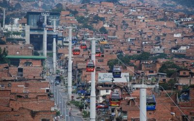
Working in the Antipodes
I was asked by ReVista to write an article on my own work, specifically about the fact that I do simultaneous work on social housing and high-profile architectural projects, something that is, to…
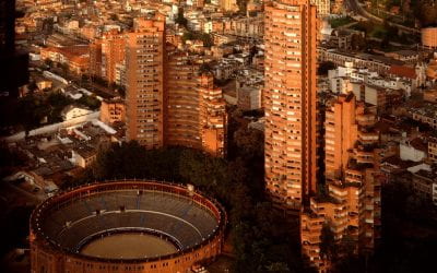
Three Tall Buildings
I used to hate the three tall towers that thrust against the verdant mountains. I used to think that the red brick towers dug into the landscape, belonging to some other city and some other space, created a scar of modernity…
