The Challenges of Rural Transportation in Mexico
Personal Encounters
I remember my first encounter with rural transportation.
I’d left my job in the Secretariat of Urban Development and Ecology of the Mexican federal government, and founded a nonprofit civil association, together with some colleagues I’d met through that job. We sought to consult on issues of housing and urban development in favor of marginalized communities or those socially at risk, to use the latest terminology.
One of my associates had contact with a philanthropic fund that offered resources to improve the material conditions of these types of communities. My first contact with the scope of rural transportation involved implementing a grant from this fund to finish and improve an access road to a rural indigenous community in the state of Michoacán.
The community was located in the slopes of a mountainous zone, a scattered hamlet with a population of a couple of hundred residents. People had to walk, crossing a small river to reach the nearest highway, which, fortunately, was only a couple of miles away. In previous years, a small bridge for cars had been constructed, but paradoxically it did not connect with the main road and the frequent landslides due to heavy rains made it impassable.
Past the bridge, if they could afford to, people could get some sort of transportation to get to the nearest city where they could sell their extra agricultural products and buy others or use health and educational services.
English-speaking countries commonly refer to transportation that is not urban as rural transportation, while in Spanish, we usually use the word “interurbano,” that is, between cities. Moreover, both urban transportation and interurban transportation usually conjures up the transportation or movement of people, although we know that both terms include the transportation of merchandise, also known as freight transport. Both, the transportation of people and of merchandise, which are clearly distinguished among themselves by the form of production and consumption or use, are also clearly distinguished between their urban and interurban forms. The differences come about because of the environment in which they are produced and consumed and by the distinct demands of the urban and interurban environments.
In Mexico, however, because of the geographic distribution of the population, we can distinguish a rural context, distinct from the urban and the interurban, made up of small communities, usually isolated or remote, and reserve the term “rural transportation” to refer to what occurs in and between these small communities. In the rural environment, the tranportation of people and merchandise coexists, sharing forms of production and consumption, coinciding in many cases with the demands of both. In effect, shortly after the road was finished, a bus service began to run a couple of times a day. Sadly, this service was only accessible to the small of number of people who could afford it. Some did benefit by using their bicycles. Many others used the road just as they had before—by riding donkeys, mules or horses or simply walking.
Becoming Aware through the ILO
Years later, while I was working as a researcher for the Mexican Institute of Transportation, my boss asked me to take care of an unusual invitation. The International Labour Office (OIT) needed a Latin American representative to participate in a colloquium workshop on rural transportation in the region.
In the workshop, I was asked why I thought that, in Latin America, although it has roads, many communities are still marginalized. In many, there were no roads and, in some, where there were roads, no accessible transportation was available, I replied somewhat innocently. The idea was to construct roads so that transportation providers would follow suit. It was clear that roads were a necessary condition, but not a sufficient one. Moreover, I commented, it was mainly the indigenous communities that were most marginalized.
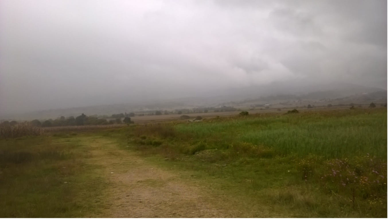
A path in an indigenous community in Mexico. // Muestra de brecha en una comunidad indígena en México
The workshop organizers, experts in development and top professors, subsequently set up the International Forum for Rural Transport and Development (IFRTD) as a non-governmental organization (NGO) based in London. It was a bootstrap operation with an executive secretary and a couple of employees, as well as four or five volunteers from Asia, Africa and Latin America who made up the board (of which I became a member), together with scholars of rural development in the United Kingdom.
The participation in the IFRTD permitted its members to exchange opinions and observations about our respective realities and to learn a lot about the situation of rural poverty that our countries shared in relation to transportation and mobility. Meetings sponsored with the help of funds from Sweden and Switzerland allowed us to meet in Peru, Sri Lanka, Kenya and years later in Mexico and to learn close up—although in a limited fashion—about the conditions of rural transportation.
We observed that roads or highways were not sufficient, but were necessary for other actions to promote mobility and to open opportunities for basic services and, eventually, for better standards of living. Among such actions were the acceptance and promotion of intermediate means of transport, including those that were not motorized. To favor their use, the perspective of gender had to be included. In many corners of our countries, it is not well regarded for women to go out by themselves on donkeys, mules or on horseback, or on bicycle or motorcycle, especially in rural areas.
Applied Research
Within the Mexican Transport Institute, my job doing applied research and dissemination. of its results made it possible to contribute from the trenches to the understanding of the challenges of rural transportation and to propose possible solutions.
We took advantage of GPS tracking and technologies that indicate global positions to construct digital maps about topography and population, including the National Road Network. With these tools, we could begin to quantify, with greater accuracy, not only the number of communities (or localities) far from paved roads, but also include those distant from dirt roads and small irregular roads (eventually including paths and footpaths). This information allowed us to conceive forms of estimating travel time in different forms of mobility and transport, including the time it takes to change from one mode of transportation to another.
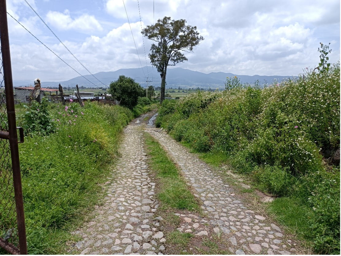
The National Road Network seeks to include paths and small, irregular roads. // La Red Nacional de Caminos busca incluir veredas y brechas
We also began several case studies in rural communities in the state of Querétaro, in both mountainous zones far from any services, and in more accessible indigenous communities, to learn the perceptions of the needs for mobility and transport. These studies have served to understand the relation between the marginalization of rural communities with accessibility to basic services: people need to have adequate access to water, energy, their farming plots, health and education services, markets and transportation services. The limitations of access and mobility gets in the way of opportunities for significantly improving and maintaining social and economic well-being; improvement of access and poverty reduction are correlated, we found.
Some Tools to Attend the Problems of Access and Rural Mobility
The tool we used to diagnose the basic services under consideration is the Integral Planning of Rural Access. This methodology of participatory local planning was developed by the International Labour Organization. It is based on the concept of rural access, determining the level of difficulty or ease with which rural dweller can use, reach and obtain goods and basic services.
We applied this methodology in four socially vulnerable rural micro-regions in the state of Estado de Querétaro (central Mexico), with both indigenous and mestizo (mixed) populations. We found that the health service was of most concern because it represented more than half of the problems of access mentioned by the inhabitants of the micro-regions studied. After health, came transportation and education, which together accounted for more than 80% of problems of access.
The other problems of access were distributed among the services related to the availability of potable water, sewage, administrative errands, markets and highways.
When people try to get health care in rural areas, they often find that there is a lack of qualified medical personnel. Given the distance from urban centers and the low populational density, rural doctors divide their time on a schedule in different health centers, which means no health service is available in a given community on certain days; residents have to go to nearby towns or wait for the doctor to come back to their town.
Since medicine is often not available at the health centers, people often get medicine on their own, which means they have to travel to larger communities or even the municipal capital. The solution to this problem of access to health services is to increase the availability of medical personnel and the distribution of medicine in the community: both challenges have to do with transportation.
In direct relation to transportation, the problems of access are primarily in four areas. First of all, it’s necessary to improve transportion between one community and another. Residents mentioned in the survey that fares needed to be more accesible; the frequency of service needs to be improved and the hours adjusted to conform to the needs of the passengers, as well as to increase how many passengers each vehicle can take. While the fares are not high, they represent a large percentage of income, given that the people in these commjnities earn very little. Passenger transport vehicles come by very seldom, and it’s impossible to get collective transport after 7 p.m. Finally, transportation units, known as “combis” or “micros” only have capacity for 15 or 20 passengers, respectively. This means if the combi or micro is full, the passenger has to wait for the next one, losing even more time.
It’s also imperative that public transportation service be extended to communities without transportation. Only three of the communities have markets and plazas, so most people had to travel to stock up on food supplies. This means that the combis and micros are also used to transport merchandise, which makes them a type of mixed-use vehicle.
Moreover, a good and economical transportation system to get youth to schools is necessary because the cost of young people going to study in nearby towns is very high compared to their family income.
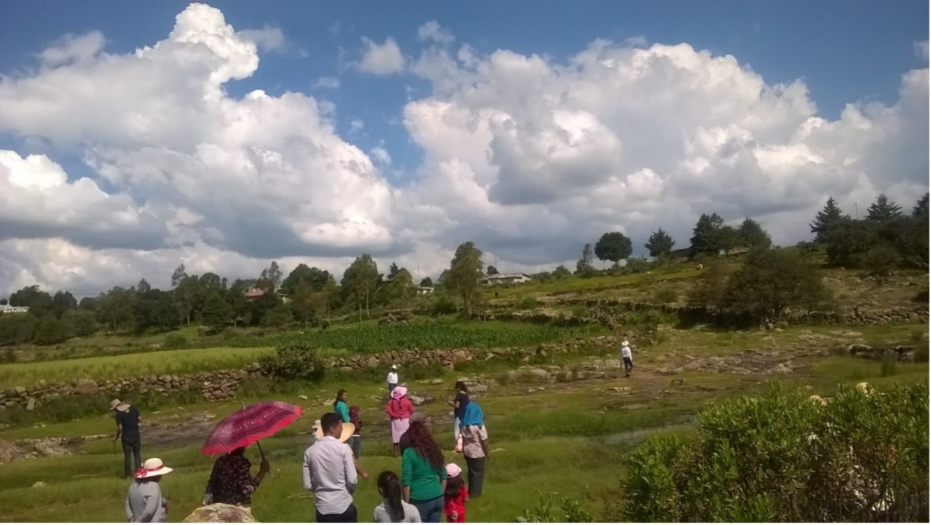
Community meeting to identify transportation problems // Reunión comunitaria para identificar problemas de transporte
After primary school, youth have to travel for studies. There are three campuses for high school: one in the municipal seat, and the other two in the Otomi microregions. Students have to go to these schools from all the neighboring communities. Thus, we observed that the northern zone was underserviced because students have to travel for more than an hour to get to one of these campuses.
The municipal president told us that thanks to our study he could justify a new campus. State officials usually have a centralized version (which happens both at the state and federal level) and they had see the existing campuses as adequate, without considering the territorial distribution of the population or their actual mobility restrictions.
Rural communities’ accessibility to cities and towns determines whether residents have different opportunities to get well-paying jobs or to get basic services such as health and education. In these studies, we could identify an opportunity to get these goods and services to these disadvantaged rural communities in an adequate and timely fashion. The concept of adequate provision is also known as management of a supply chain to get food and other goods and services from the countryside to the city.
There are two possible ways of approaching this.
- Short supply chains, which seek direct sales between the local (rural) food producer and the final consumer, minimizing as much as possible the quantity of intermediaries and distances between them so that the goods arrive more quickly and at a lower cost.
- Humanitarian logistics, understood at the timely provision of food to the neediest, through supply chains specialized in food.
These rural communities also have other socio-economic needs such as health, education, jobs, transportation (services and infrastructure) and administrative matters that must be met. These sectors are priorities to maintain or elevate the quality of life, so a precise diagnosis of what basic services should be provided first in order to make the most of available human, material and financial resources, thus responding adequately to needs of the rural poor.
As we mentioned, the IRAP methodology identifies how accessible basic services are for the residents of any given community by creating an accessibility index that allows us to prioritize those sectors or services in order of importance, to focus on one sector at a time and thus generate feasible solutions to solve these problems, to take maximum advantage of available resources which almost always are limited.
Once problems have been ranked according to impact and ease of implementation, we saw that developing proposals for rapid and economic solutions called for the participation of the community and local government in town-hall meetings or workshops to validate the possible solutions.
Among the useful tools we encountered to attend to high priority problems were specialized methods for the location of installations and for the mapping of routes with a social focus. Methods for the location of installations apply to a wide variety of situations such as where to locate a family health clinic, a school or a fire station. These decisions are considered strategic because they involve significant investments and modifications can generate high costs.
Traditionally, the models of determining the locations of installations look for the solution that offers the lowest cost of distribution. An example of this is the case of companies like Amazon or Walmart, looking for the best location for its next merchandise distribution center. However, when the locations involve health or education, the focus should change and the goal should be to serve as many people as possible and that rural populations can get to these centers in a reasonable amount of time. In other words, once it’s been decided how many installations (health centers, for example) the budger will permit, the next step is to figure out ideal location to attend the greatest number of people, and that they do not have to travel more than an allotted amount of time and that they not spend more than a certain amount of money in the process. This method with adequate focus is called the maximum coverage method.
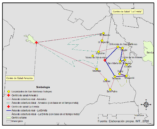
Cobertura de servicios de salud en una microrregión de Querétaro
We apply this model of maximum coverage to propose new health centers in the municipality. We see that the medical personnel and medicines were limited, as well as the coverage of these health installations. Moreover, the fact that infrequency of transportation and the distribution of routes is based on the municipal seat and not on the communities made it necessary for people to transfer from one mode of transportation to another quite often to obtain the services. With a transport system with sufficient frequency or with adequate coodination, greater coverage could be obtained so that people did not have to travel more than half an hour or three miles. These threshholds of time and distance are in accordance with the Secretary of Health of Mexico, taking into account that the majority of trips are on foot.
The problems of the shortest route consist of finding the best route or road between the starting point and the destination, tied together with a network of roads, so that one has to follow the road that minimizes the distance or the cost. In the rural zones, the conditions of the roads mean that vehicles have to travel very slowly, and in the case of irregular dirt roads, rural residents have to walk long distance, so time must be taken into account as people seek goods or services.
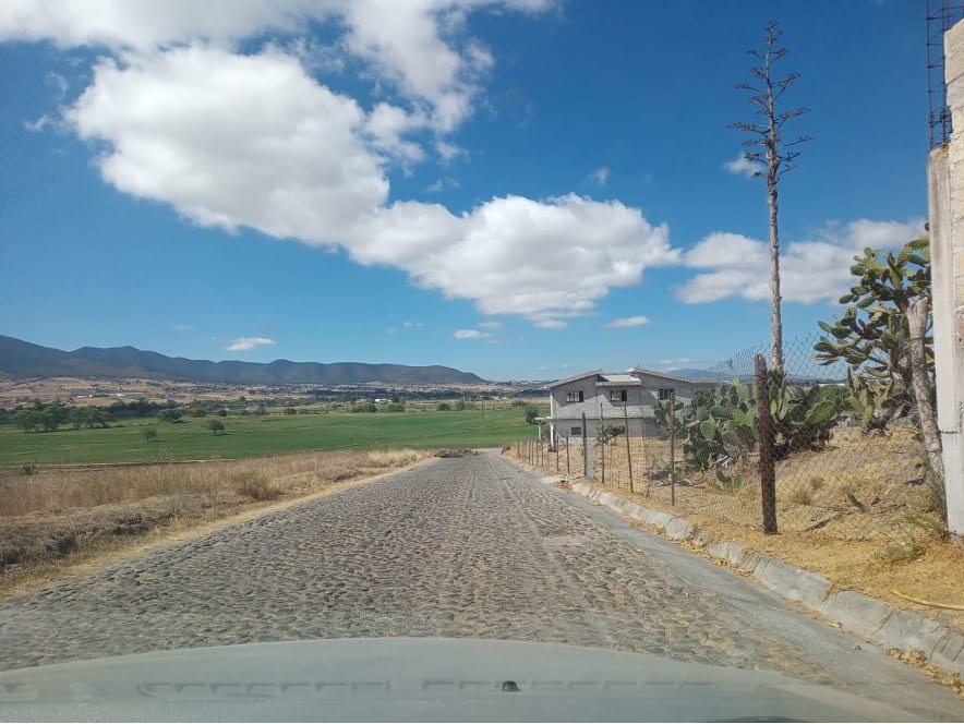
Road conditions make for long journeys. // Las condiciones del camino pueden provocar largos tiempos de recorrido
When I want to buy supplies, I have many options that we take for granted in large metropolitan zones: I can go to the mall that is closest to my house or the most elegant or the most modern one, not to mention all the options of buying online. We forget that these options don’t represent the daily realities of the people in rural areas. Their challenge is not a small one: in spite of the fact that when we visited some of these villages, we only saw a few people, on the national level, rural dwellers have a larger population than the entire population of Chile or Bolivia—and double the number of people in Greece.
The Size of the Challenge

Grado de rezago social a nivel municipal, CONEVAL 2020
The National Council on the Evaluation of Social Development (CONEVAL) is the autonomous governmental agency that generates information on the situation of social policy and poverty alleviation in Mexico. In its 2020 report, which identified communities most at social risk, one can observe a relationship between poverty density and social risk. That is, although there are neighborhoods in the large metropolitan zones at great risk, people in rural zones have far more difficulty in obtaining the goods and services they need, if they live in remote zones. The National Institute of Statistics and Geography (INEGI) found in 2015 that, although in Mexico, there are about 2,500 municipalities, almost two-thirds of its population is located in 74 metropolitan zones. On the other hand, 21 %, almost 27 million of Mexicans, live in places with fewer than 2,500 residents, of whom 60% live in situations of poverty. Social risk is even higher among the indigenous population: almost 12 million of the national total are indigenous and more than 70% of them live in poverty. These statistics illustrate the phenomenon of concentraton and the scattering of population throughout the country and the relationship between the rural environment, the indigenous population and social risk. Designing an orderly system of transportation for rural communities will not do away with poverty, but it is an important first step to giving people access to health, education and jobs.
El desafío de transporte rural en México
Experiencias personales
Por Roberto Aguerrebere y Agustín Bustos R.
Me acuerdo de mi primer contacto con el transporte rural.
Había yo dejado mi empleo en la Secretaría de Desarrollo Urbano y Ecología del Gobierno federal de México y con algunos compañeros que conocí en ese trabajo formamos una asociación civil sin fines de lucro. La intención era dar asesoría en temas de vivienda y desarrollo urbano para la atención de comunidades marginadas o rezagadas socialmente.
Uno de los asociados tenía contacto con un fondo filantrópico de ayuda que brindaba recursos, justamente para mejorar las condiciones materiales de este tipo de comunidades. Mi primer contacto con el ámbito rural del transporte consistió en aplicar un donativo de dinero de ese fondo, en completar y mejorar el camino de acceso a una comunidad rural indígena en el estado de Michoacán.
La comunidad se ubicaba en las faldas de una zona montañosa, en un caserío disperso con una población de un par de cientos de habitantes. Las personas tenían que caminar, cruzando un pequeño río, para llegar a la carretera más próxima, afortunadamente no más que cinco kilométros de distancia. En años anteriores, habían hecho ya un pequeño puente vehicular, pero paradójicamente no se conectaba con un camino completo y los deslaves por lluvias en la brecha parcialmente existente eran frecuentes, lo cual la hacía intransitable.
Terminado el camino las personas podrían acceder a algún medio de transporte para llegar a la ciudad más cercana, donde podrían vender sus productos agrícolas excedentes y comprar otros o acceder a servicios de salud y de educación. Efectivamente, al poco tiempo de concluido el camino, un servicio de autobús empezó a recorrerlo un par de veces al día. Lamentablemente, el mayor beneficio de este servicio fue solamente accesible a una pequeña parte de la población con ingresos suficientes para pagarlo. Algunos más se beneficiaron transitando en bicicleta. Otros muchos, recorrieron el trecho como antes: montando burro, mula o caballo o a pie.
En los países de habla inglesa suelen referirse – comúnmente – al transporte que no es urbano como transporte rural, para referirse a lo que en español podemos denominar transporte interurbano, es decir, entre ciudades. Además, tanto el transporte urbano como el transporte interurbano evocan usualmente el transporte o movimiento de personas, aun cuando sabemos que dichos términos también incluyen al transporte de mercancías, también llamado transporte de carga. Ambos, el transporte de personas y el de mercancías, que claramente se distinguen entre sí por su forma de producción y consumo o utilización, también se distinguen entre sus formas urbanas e interurbanas. Las diferencias son, principalmente, debidas a las características del ámbito en el que se producen y consumen y a las de su demanda, inherentes a dichos ámbitos: el ámbito urbano y el ámbito interurbano.
En México, sin embargo, dadas las características de distribución geográfica de la población, podemos distinguir un ámbito rural, distinto del urbano y del interurbano, que comprende pequeñas comunidades, usualmente aisladas o remotas, y reservar el término transporte rural para referirnos al que ocurre en y entre tales pequeñas comunidades. En este ámbito rural, coexisten muchas veces el transporte de personas y mercancías, compartiendo formas de producción y consumo, coincidiendo también en muchas ocasiones, la demanda de ambos.
Este tipo de transporte rural existe, en general, en aquellos países en los que el patrón de distribución de la población tiene similitudes con lo arriba descrito. En América latina, por ejemplo, muy probablemente se presenta en los países andinos, así como en América Central.
Haciendo conciencia con la OIT
Años después, siendo investigador del Instituto Mexicano del Transporte, mi jefe me pidió atender una singular invitación. La Oficina Internacional del Trabajo (OIT) requería de un representante de América Latina para participar en un taller de discusión sobre el transporte rural en la región.
En el taller me preguntaron cuál consideraba que era la razón principal por la que, en América Latina, a pesar de haber caminos, muchas comunidades seguían marginadas. En muchas no había caminos y en aquellas donde sí los había, no había transporte accesible, dije, ingenuamente. Se tenía la idea de que bastaba construir los caminos para que surgieran prestadores de servicios de transporte. Era claro que los caminos eran condición necesaria, mas no suficiente. Además, comenté, son principalmente las comunidades indígenas las más marginadas.

A path in an indigenous community in Mexico. // Muestra de brecha en una comunidad indígena en México
A iniciativa de los organizadores de ese taller, especialistas en desarrollo y académicos de primera línea, surgió el International Forum for Rural Transport and Development (IFRTD). El IFRTD se constituyó en Londres como una organización no gubernamental sin fines de lucro, con una Secretaría Ejecutiva y un par de empleados, además de 4 o 5 voluntarios de Asia, África y América Latina, que conformamos el Consejo, junto con académicos o estudiosos del desarrollo rural del Reino Unido.
La participación en el IFRTD nos permitió a sus miembros intercambiar opiniones y percepciones de nuestras respectivas realidades y conocer mucho de lo que la problemática de la pobreza rural de nuestros países tenía en común en relación con la movilidad y el transporte. Reuniones patrocinadas por fondos de ayuda de Suecia y Suiza nos permitieron reunirnos en Perú, Sri Lanka, Kenia y años después en México, y conocer de cerca— aunque limitadamente—las condiciones del transporte en el medio rural.
Constatamos, eso sí, que los caminos o las carreteras no eran suficientes y que sí eran necesarias otras acciones para catalizar la movilidad y abrir las oportunidades de acceso a servicios básicos y, eventualmente, a mejores niveles de bienestar material. Entre tales acciones se encontraba la aceptación y promoción de medios intermedios de transporte, incluyendo los no motorizados, y que para favorecer su utilización era indispensable también el enfoque de género. En muchos de nuestros países no era bien visto que las mujeres anduvieran solas, en burro, mula o a caballo, o en bicicleta o motocicleta, mucho menos en el ámbito rural.
La investigación aplicada
Desde en el Instituto Mexicano del Transporte, la posibilidad de contribuir a conocer la problemática del transporte rural y plantear posibles soluciones se dio desde la trinchera de la investigación aplicada y la difusión de sus resultados.
Por un lado, aprovechamos las tecnologías de los sistemas de información geográfica y las de los de posicionamiento global y la construcción de mapas digitales con la información topográfica y de población, incluyendo la Red Nacional de Caminos. Con estas herramientas, pudimos empezar a cuantificar, con mayor aproximación, no sólo la cantidad de comunidades (o localidades) alejadas de carreteras pavimentadas, sino incluso de caminos de terracería y brechas (eventualmente, incluso senderos y veredas), abriendo con ello la posibilidad de concebir formas de estimar los tiempos de recorrido de distintas formas de movilidad y transporte, considerando también el relieve.

The National Road Network seeks to include paths and small, irregular roads. // La Red Nacional de Caminos busca incluir veredas y brechas
Por otro lado, emprendimos diversos estudios de caso en comunidades rurales en el estado de Querétaro, tanto en zonas serranas alejadas de centros de servicios (Balbuena Cruz et al 2015, 2014), como en zonas de comunidades indígenas más accesibles, para conocer la percepción de sus necesidades de movilidad y transporte. Estos estudios han servido para entender la relación que tiene la marginación en comunidades rurales con su accesibilidad a servicios básicos: las personas necesitan tener un adecuado acceso al agua, la energía, las parcelas de sus cultivos, los servicios de salud, la educación, los mercados y los servicios de transporte. Las limitaciones de acceso y movilidad obstaculizan significativamente las oportunidades para mejorar y mantener su bienestar social y económico: la mejora del acceso y la reducción de la pobreza están correlacionadas.
Algunas herramientas para atender problemas de acceso y movilidad rural
La herramienta que usamos para diagnosticar los servicios básicos a atender es la Planificación Integral del Acceso Rural (IRAP). Ésta es una metodología de planificación participativa local, desarrollada por la Organización Internacional del Trabajo. Está basada en el concepto de acceso rural, el cual se considera como el nivel de facilidad o dificultad de los pobladores rurales para usar, alcanzar u obtener los bienes y servicios básicos.
Aplicamos esta metodología en cuatro microrregiones rurales de alto rezago social localizadas en un municipio del Estado de Querétaro (centro de México), tanto con población indígena como mestiza. Encontramos que el servicio de salud es el más preocupante, pues representa más de la mitad de los problemas de acceso mencionados por los habitantes de las microrregiones estudiadas. En orden de importancia, a los problemas de salud le siguen los de transporte y los de educación que, juntos, agrupan más del 80% de los problemas de acceso.
Los demás problemas de acceso se distribuyen entre los servicios relacionados con la disponibilidad de agua potable, drenaje sanitario, trámites administrativos, mercados y carreteras.
Con respecto al servicio de salud, entre las causas identificadas están la falta de personal médico calificado. Dada la lejanía a los centros urbanos y a la baja densidad poblacional, cada médico rural divide su tiempo en casas de salud de distintas comunidades conforme a un rol de días, lo que hace que en algunos días no haya servicio disponible en una comunidad y la gente tenga que ir a pueblos vecinos o esperar a que el rol de servicios médicos atienda de nuevo a su pueblo.
También existe una grave escasez de medicamentos. Esta provoca que la gente tenga que conseguir la medicina por su cuenta, para lo que tiene que ir a comunidades más grandes o incluso a la cabecera municipal. De esta forma, las soluciones al problema de acceso a servicios de salud deben dirigirse a incrementar la disponibilidad del personal médico y el suministro de medicinas en las comunidades: ambos retos tienen que ver con el transporte.
En relación al servicio de transporte, los problemas de acceso se concentran en tres áreas.
El primero es mejorar el servicio de transporte que opera entre las comunidades. Los pobladores nos mencionaban que se necesita mejorar la tarifa; aumentar la frecuencia del servicio y ajustar el horario de las rutas de transporte a las necesidades de los usuarios y, finalmente, aumentar la capacidad de las unidades. Las tarifas, si bien no son tan altas, representan un porcentaje alto del ingreso dados los bajos ingresos de los habitantes de las comunidades. Los vehículos de transporte de pasajeros pasan con una frecuencia baja en horarios reducidos: no se puede conseguir transporte colectivo después de las siete de la noche. Finalmente, las unidades de transporte, las llamadas “combi” o “micro” tienen capacidad de únicamente 15 o 20 pasajeros, respectivamente, por lo que, si la unidad va llena hay que esperar a la que sigue, con lo que se pierde aún más tiempo.
El segundo es proveer de servicio de transporte público en aquellas comunidades que carecen del mismo. Al haber solamente tres con mercados y plazas, la mayoría de la gente viaja para abastecerse. Esto hace que las unidades de pasajeros también sean usadas para llevar mercancías, lo que las hace una suerte de vehículos de uso mixto.
El tercero es proveer de servicio barato de transporte escolar para secundaria y bachillerato. El gasto de transporte para que viajen los jóvenes a la secundaria o bachillerato es muy alto comparado con el bajo ingreso de las familias.

Community meeting to identify transportation problems // Reunión comunitaria para identificar problemas de transporte
En general, estudiantes más allá de la primaria tienen que viajar. Se cuenta con tres planteles de nivel bachillerato: uno en la cabecera municipal, los otros dos en las microrregiones de mayoría otomí; los estudiantes deben trasladarse desde las demás comunidades. Así, vimos que la zona norte quedaba muy desatendida puesto que tenían que viajar más de una hora para poder llegar a algunos de estos planteles.
El presidente municipal nos comentó que gracias a este estudio pudo justificar un nuevo plantel ya que las autoridades estatales tenían una visión centralizada (que se da en todos los estados y a nivel federal) y para ellos los planteles existentes eran suficientes, sin considerar la distribución territorial de la población o sus tiempos de viaje.
La ubicación geográfica de las localidades rurales respecto de las ciudades determina oportunidades diferentes de obtener un empleo bien remunerado o acceder a servicios básicos como educación y salud. Con los estudios que realizamos pudimos identificar una ventana de oportunidad en la provisión adecuada y oportuna de productos y servicios básicos a las comunidades rurales en desventaja. Esta provisión adecuada se conoce también como gestión de cadenas de suministro y para el caso de hacer llegar alimentos y demás bienes y servicios del campo a la ciudad se puede hacer bajo dos enfoques:
- Cadenas de suministro cortas, que busca la venta directa entre el productor local (rural) de alimentos y el consumidor final minimizando en todo lo posible la cantidad de intermediarios y distancias entre ellos, con lo que los bienes les llegarán más rápido y a un costo menor.
- Logística humanitaria, entendida como la oportuna entrega de alimentos a los más necesitados, a través de cadenas de suministro especializadas en alimentos.
En estas comunidades rurales también se tienen otras necesidades socioeconómicas tales como salud, educación, empleo, transporte (servicios e infraestructura) y trámites administrativos, que deben ser atendidas. Todos estos sectores son prioritarios para mantener o elevar su nivel de vida, por lo que requiere de un diagnóstico preciso de cuáles sectores o servicios básicos deben ser atendidos primero para optimizar los recursos humanos, materiales y financieros disponibles y así responder adecuadamente a las necesidades de la población rural pobre.
Como mencionamos, la metodología IRAP permite identificar qué tan accesibles son los servicios básicos a los habitantes de una comunidad mediante la estimación de un índice de acceso que permite jerarquizar los sectores o servicios en función de su importancia, para enfocarnos en un sector a la vez y, así, generar las soluciones factibles que permitan resolver dichos problemas, con lo que aprovechamos al máximo los recursos disponibles que casi siempre son limitados.
Una vez que se han jerarquizado los problemas de acuerdo con su impacto y facilidad de implementación, vimos que para poder elaborar propuestas de solución rápida y de bajo costo, se requiere de la participación conjunta de la comunidad y del gobierno local en reuniones comunitarias o talleres de validación.
Entre las herramientas que encontramos de gran utilidad para atender los problemas prioritarios, existen métodos especializados de ubicación de instalaciones y métodos de ruteo con enfoque social.
Los métodos de ubicación o localización de instalaciones se aplican a una amplia gama de situaciones, como dónde ubicar un centro de salud familiar, una escuela o una estación de bomberos. Estas decisiones se consideran estratégicas, pues implican niveles importantes de inversión y cualquier cambio genera altos costos.
En un enfoque tradicional, los modelos de localización de instalaciones buscan la solución que ofrezca el costo mínimo de distribución. Ejemplo de esto puede ser el caso de empresas como Amazon o Walmart buscando la mejor ubicación para su próximo centro de distribución de mercancías. Sin embargo, cuando se trata de servicios de salud o educativos, el enfoque debe cambiar y la meta a lograr debe ser atender a la mayor cantidad de población posible y que esta población utilice solamente el tiempo razonable en la distancia adecuada. En otras palabras, una vez que se define para cuántas instalaciones (centros de salud, por ejemplo) se tiene presupuesto, el siguiente paso es identificar su ubicación idónea, de tal manera que se atienda a la mayor población posible y que la gente no viaje más de cierto tiempo y no gaste más que cierta cantidad de dinero. El método con el enfoque adecuado es, entonces, es el de cobertura máxima.

Cobertura de servicios de salud en una microrregión de Querétaro
De esta manera, aplicamos este modelo de cobertura máxima para proponer nuevos centros de salud en el municipio. Vimos que el personal médico y las medicinas eran limitados, así que la cobertura de dichas instalaciones de salud era insuficiente. Además, la baja frecuencia de transporte y la distribución de rutas basada en la cabecera municipal y no en las comunidades, hacía necesario realizar transbordos. De contar con un sistema de transporte con frecuencias suficientes o con una coordinación adecuada, se podría abarcar una mayor cobertura, de tal manera que la gente no tuviera que trasladarse más de media hora o cinco kilómetros. Estos umbrales de tiempo y distancia son acordes con las recomendaciones de la Secretaría de Salud de México, tomando en cuenta que gran parte de esos trayectos se tienen que recorrer a pie.
Los problemas de ruta más corta consisten en encontrar una ruta o camino óptimo entre un origen y un destino, los cuales están enlazados a través de una red de caminos, de tal manera que se siga el camino que minimice la distancia o el costo. En las zonas rurales las condiciones del camino provocan que los vehículos viajen a velocidades muy bajas, en el caso de brechas, los habitantes tienen que caminar distancias largas, por lo que también se debe considerar el tiempo de trayecto que gasta la gente para hacerse de un bien o servicio.
Las condiciones del camino pueden provocar largos tiempos de recorrido
Cuando quiero comprar mi despensa, dispongo de opciones que en las grandes zonas metropolitanas damos por hecho: puedo ir al centro comercial más cercano, al más lujoso o al más moderno; además de las opciones de compras en línea. Nos olvidamos que esas facilidades no corresponden a la cotidianeidad de la gente que vive en zonas rurales. El reto no es menor: a pesar de que cuando por alguna razón visitamos uno de estos pueblos pudiéramos ver poca gente, a nivel nacional forman una población mayor a la de países enteros como Chile, Bolivia o el doble de la población de Grecia.
El tamaño del desafío

Grado de rezago social a nivel municipal, CONEVAL 2020
El Consejo Nacional de Evaluación de Desarrollo Social (CONEVAL) es el órgano gubernamental autónomo que genera información sobre la situación de la política social y la medición de la pobreza en México. En su reporte de 2020, que identifica aquellas comunidades que tienen mayor rezago social, se puede observar que existe una relación geográfica entre la densidad de población y el rezago social. Esto es, aunque existen barrios y colonias con rezago en las grandes zonas metropolitanas, es más probable encontrar gente con mayor dificultad para obtener los bienes y servicios que necesitan, si se encuentran en comunidades remotas. El Instituto Nacional de Estadística y Geografía (INEGI) encontró en 2015 que, aunque en México existen casi 2500 municipios, casi dos terceras partes de la población se concentra en 74 zonas metropolitanas. Por otro lado, el 21 %, casi 27 millones, vive en localidades de menos de 2500 habitantes, de los cuales el 60% vive en situación de pobreza. El rezago social se ve acentuado en la población indígena: casi 12 millones del total nacional son población indígena y más de 70% de ellos vive en situación de pobreza. Estos datos muestran el fenómeno de concentración—dispersión de la población en el país y la relación entre el ámbito rural, la población indígena y el rezago social. Diseñar un mejor sistema de transporte rural no eliminará por completo la pobreza; sin embargo, es un primero paso importante para mejorar el acceso a la salud, la educación y el empleo de todos los mexicanos.
Fall 2021, Volume XXI, Number 1
Roberto Aguerrebere was a researcher and Managing Director of the MexicanTransportation Institute. He has interdisciplinary technical-economic expertise in the areas of tranportation, mobility and logistics, their security and sustainability Contact: roberto.aguerrebere.imt@gmail.com
Agustín Bustos is the senior researcher at the Mexican Transportation Institute. He holds a doctorate in logistics and has worked on the topics of freight cargo, intermodalities, supply chains and rural transportation. Contact: agustinbustosr@gmail.com
Roberto Aguerrebere fue investigador y Director general del Instituto Mexicano del Transporte; cuenta con experiencia en estudios técnico-económicos interdisciplinarios sobre transporte, movilidad y logística, su seguridad y sostenibilidad. Contacto: roberto.aguerrebere.imt@gmail.com,
Agustín Bustos es investigador titular del Instituto Mexicano del Transporte, doctor en logística; ha trabajado en temas de transporte de carga, intermodalismo, cadenas de suministro y transporte rural. Contacto: agustinbustosr@gmail.com
Related Articles
Editor’s Letter: Transportation
Bridges. Highways. Tunnels. Buses. Trains. Subways. Transmilenio. Transcable. When I first started working on this issue of ReVista on Transportation (Volume XXI, No. I), I imagined transportation as infrastructure.
Modernity in Black and White
For years, one of my favorite pieces in the Museo de Arte Latinoamericano de Buenos Aires (MALBA) was the iconic Abaporu (1928), by Brazilian artist Tarsila do Amaral: a canvas…
Transportation Itself Does Not Build Urban Structures
English + Español
Fina Rojas lives in the 19 de Abril at Petare, the densest and one of the largest self-produced neighborhoods in Latin America. Most researchers and policymakers define self-produced neighborhoods as “informal settlements.” However, these settlements occur from…
